ores.geo
Table of Contents
Diagram
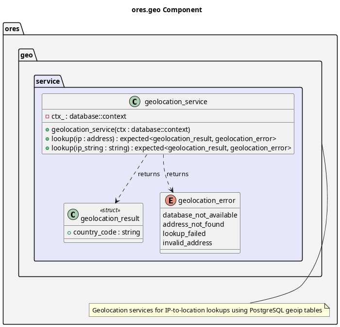
Figure 1: ores.geo
Summary
ores.geo provides IP-to-geographic-location lookups for ORE Studio. It stores
MaxMind GeoLite2-City data (countries, cities, IPv4/IPv6 CIDR blocks) in
PostgreSQL and exposes a geolocation_service that maps any IP address to
country, city, and coordinates. It is used by ores.iam to record the
geographic origin of login sessions for audit and security purposes.
Inputs
- IP address (IPv4 or IPv6) from a login request or session context.
- MaxMind GeoLite2-City CSV data loaded into PostgreSQL tables
(
geoip_locations,geoip_blocks_ipv4,geoip_blocks_ipv6).
Outputs
- Geographic location record: country, city, latitude/longitude for a given IP.
Entry points
include/ores.geo/service/geolocation_service.hpp— IP lookup API.
Dependencies
ores.database— PostgreSQL connection pool forgeoip_*queries.- PostgreSQL GiST indexes on
inetcolumns for efficient CIDR matching.